The Wapusk Trail Fat Bike Expedition w/ Buck Miller, Eric Batty and Ryan Atkins
Posted by Steve on 10/29/20
Last modified: 02/01/21
Words by Buck Miller. Images by Eric Batty.
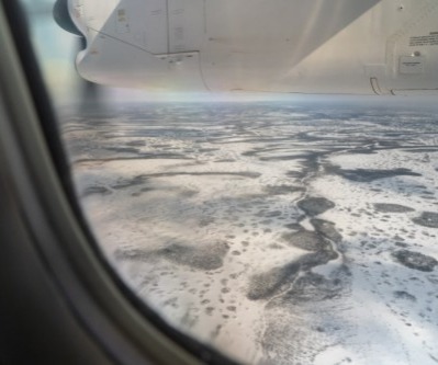
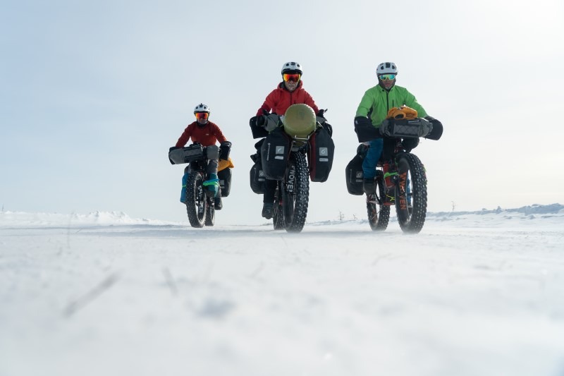
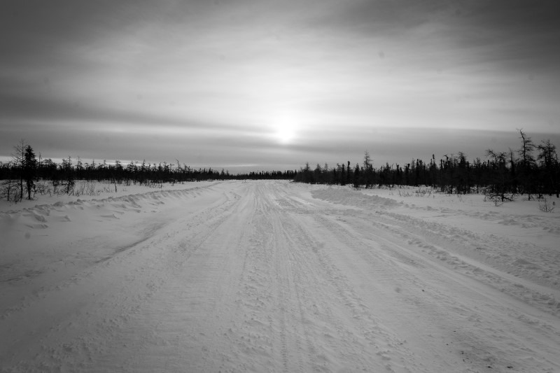
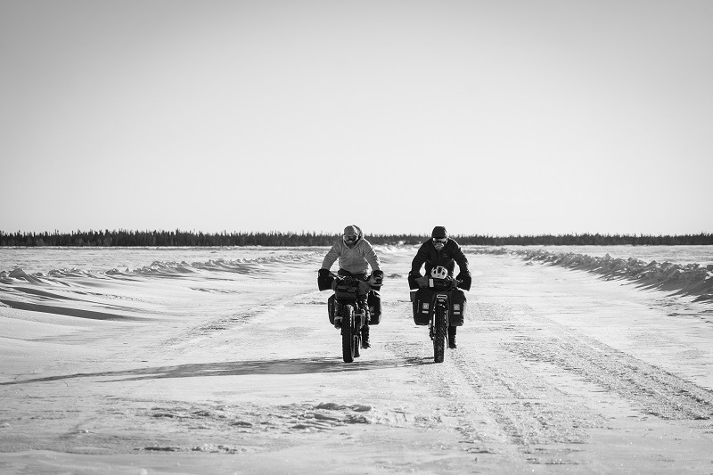
This past March, exactly three days before Canada went into Covid-19 lockdown myself and two expedition teammates Eric Batty and Ryan Atkins, were in a tiny airport boarding a small twin prop plane in Timmins, Ontario and heading for Peawanuck First Nation on the coast of the enormous Hudson’s Bay. We attempted the first Fat Bike expedition on what Guinness World Records calls the “longest winter road in the world”, The Wapusk Trail. Wapusk is Cree for white bear, white bear is english for, well, you get it. The 450mi ride cuts straight through Ontario’s largest protected wilderness area, Polar Bear Provincial Park. It’s accessible only by bush plane in three seasons and this ice road in winter. There’s no services out here, no signs, no gravel, just 10,000 square miles of protected wilderness over frozen muskeg that’s in 310,000 square miles of Northern Ontario wilderness already. This area cuts in and out of the tree line, so huge open swamps and small stunted spruce trees set the scene for the inaugural expedition into the unknown. In this area of the Bay, beluga whales chase arctic char and seals try to avoid Polar Bears. Caribou outnumber moose and ptarmigan flock to the cranberries frozen beneath our studded Dillinger 5 tires. To give you an idea as to how remote this region of Canada is, in the same amount of distance our trip covered, 450 miles, on the Iditarod Trail you would have passed through ten checkpoints. We passed through two, which were remote towns at mile 125 and mile 277. The entire route from east to west is about 1000mi north of Toronto/Detroit and is in the center of Canada.
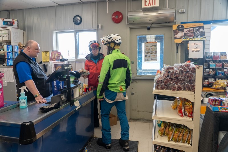
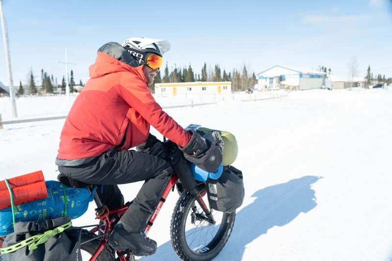
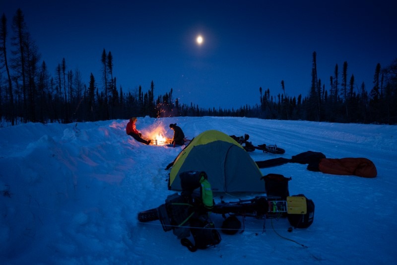
We started the expedition in Weenusk First Nation with two goals. 1 - raise $10,000 to support local Indigenous youth to stay active and 2 - become the first athletes to take on the Wapusk Trail under human power. With our plan set and gear dialed we started out on March 10th. The plane landed in Peawanuck under a beautiful blue sky and a nice -2f. We met an Elder at the only store in town, a very nice woman who said “if you see a wapusk, don’t take pictures, kill it” as she used her cane to help throw a leg over the snowmachine she was riding to get groceries. In a town this small, everyone knew what we were up to and they all warned us of the bears. Sightings were happening all over the route. We rolled out from town slowly to get used to the heavy bikes and had some fun riding the super rolly terrain where in only a few feet of each other we would all be on different lines. We knocked out 24mi and left town at 3pm. We set up camp quick but all debated on the bear fence. In the end, we decided to set it up. We slept well considering this was our first trip as a team without a stove in our tent.
Morning of day two we smashed oats and coffee to start the day. We pushed off at 9:00 and 800m down the road we saw fresh bear tracks. How do we know they were fresh? A maintenance truck rolled by camp at about 4am making us all stir in our -30 sleeping bags and the bear tracks were on top. So we kept the gun a little more accessible and didn’t debate the hassle of setting up the bear fence each night. This route isn’t on the sea ice so you might wonder why we’re in bear country. In March, the Wapusk comes inland and makes a den to have their cubs. Most of our route was in breeding country and in the first quarter of the ride we saw 5 sets of bear tracks, some coming in and some going out with little feet following. They’re tracks are huge and can often walk on top of the wind-crusted snow, often concealing their locations from us. I was eager to get some ptarmigan with my .12ga and while we saw many, they all lifted off before I could get a shell in the gun. We ended the day with 56mi and a few sets of bear tracks to talk about.
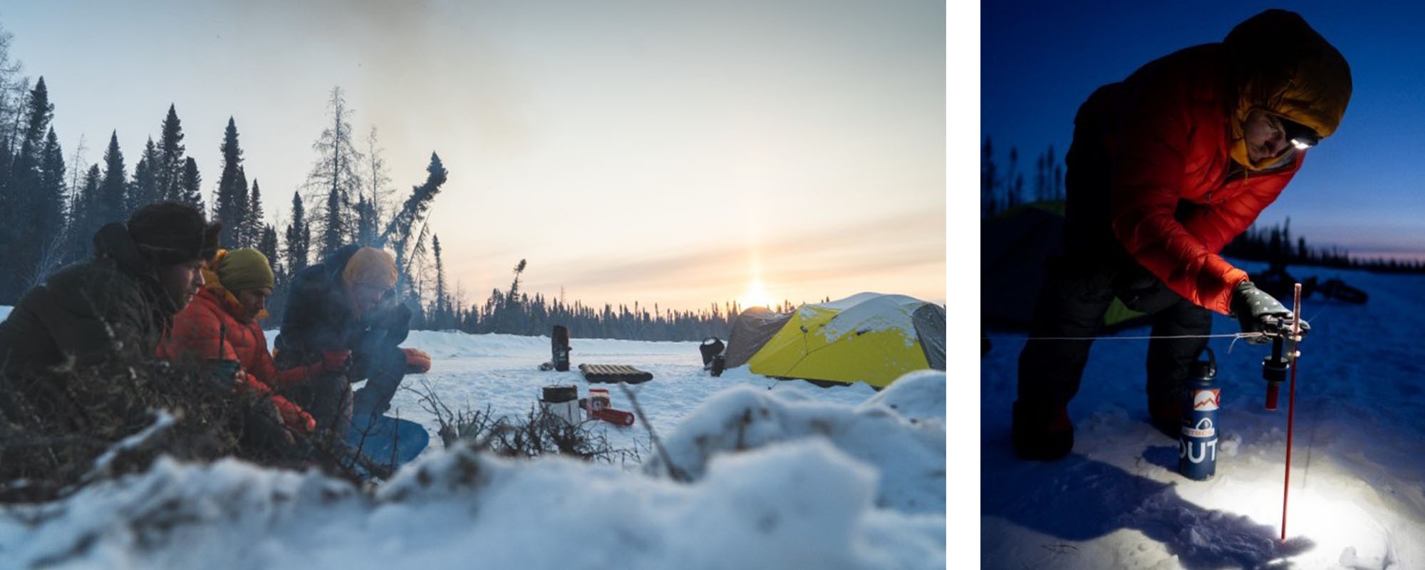
Day three started early in the night. The wind picked up around 3am. From in the tent we couldn’t tell where it was coming from but I didn’t sleep well. Wind was knocking frost off the tent walls into the tiny breathing hole I had in the -24 air. Our routine now was starting to sink in. Wake up, boil water, start a fire to keep warm while breaking down camp. We still didn’t have a single passenger truck pass us yet, only one road worker. While breaking camp a truck came by, full of people. We chatted and it turns out they were going to a funeral in Fort Severn at a cost of about $200USD to fill a tank of gas. Even grieving is something few people can afford up here. Fuel is floated in by barge from Moosonee, some 530mi away because the winter road is very rough, unreliable and long. They heard we were riding for a cause and the driver handed us $60. Money isn’t easy to come by up here. There’s no forestry, no mining and no tourism. Only a few jobs in social services. We were humbled by their kindness and generosity. We got to Fort Severn on this day. It’s the most northern community in Ontario and sits nearly at the 56th parallel but is within eyesite of Hudson’s Bay so the cold, dry arctic air hammers the community. The elders of Severn are revered for their handiwork and make some of the warmest traditional clothing with polar bear, seal and caribou hide. We were greeted and followed throughout the town by a huge pack of very friendly dogs of all shapes and sizes. Ryan literally wanted to take them home. 56mi was today’s total but it was hard fought. I was fighting a deep knot in my hamstring so Ryan and Eric were my pilots.
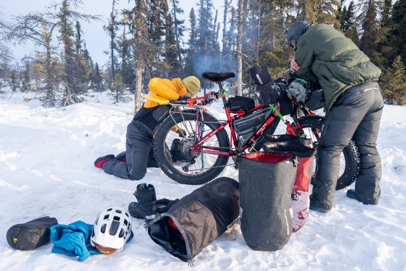
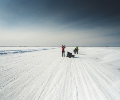
The fourth day was a riot. It warmed up a little and we ended up with snow overnight. Drifts were everywhere on the road that the wind didn’t hit. Little pockets of deep powder filled every hole in the road. Our bikes were fully kitted with bags in every spot you can think of. I even doubled down on panniers which is usually a bikepacking embarrassment. But in the center of Canada, the 55th parallel is much colder than say, Nome to Fairbanks because of our proximity to the center of the Arctic and with no open oceans anywhere near, I was confident in the extra bulk of the 4 panniers. My rig was a party wagon with tons of storage for food and feathered gear but it made for some seriously wonky steering in the drifts. I went down on my right pretty hard today. The dump snapped off the clips holding my front pannier on the rack. The lads were already way ahead and had to circle back to see what was taking me so long to get back on the bike. We used a few rubber covered wires to jerry-rig it into place and I moved my lightest things up to that pannier to hopefully make it last the remaining 350 miles. I remember getting passed by a smiling Cree woman in a huge passenger van while freezing my hands trying to wire it all up. Today ended with 60 miles behind us and the realization that we didn’t pack enough oatmeal for the remaining mornings. Crap. Luckily we had bags and bags of chocolate bars.
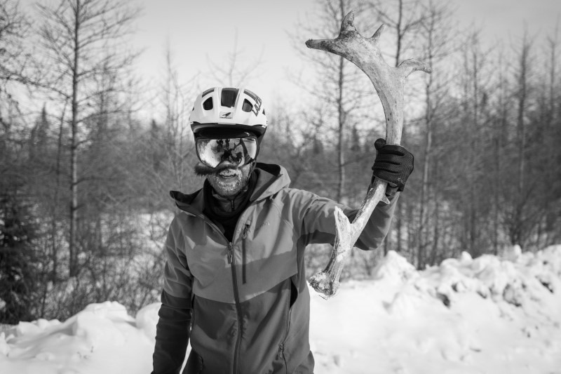
Here’s an excerpt from my bush journal about the morning of day five - “had a good sleep but I’m wicked sore. Left hammy feels like it’s about to explode. I’m loving the geography up here, who knew it would be so beautiful. Ryan and Eric are awesome, great friends to share this trip with.” Apparently I was pretty happy on day five. The big goal today was to hopefully cross into the Manitoba border and check the “trans provincial” box off our list. We had a real cold start to the day that was -32f and by mid morning the winds picked up. Through the vast swamps the wind would just cut us in half and each of us would just focus on the treeline ahead hoping to get there as fast as we could. Eric hates the wind. He gets angry at it and Ryan and I, who have a slightly more philosophical view about the wind, notice the watts pick up when Eric takes his turn. Our in-house photographer has a point to prove. What’s the point? We don’t know but I think it’s along the lines that with enough training, Mother Nature can tamed. Being less fit than my two teammates, I still shook my head a little at the impressive effort but I enjoyed the benefits. Ryan would hit the front and spend up to a mile out of the saddle at a time. His bike, wavering underneath him but always in control. At one point, I got tired of staring at the back wheel of the lads and I started looking around. A set of points caught my wandering eye and I hammered on the breaks. I’ve traveled the far north for years and have always wanted to find a Caribou “shed” or antler that naturally falls off annually. With only about 4 inches sticking out of the snow and ice, there it was. I wiggled it free after a few minutes. It had been chewed on, hit by a Snowcat and certainly driven over but was in otherwise perfect condition. About 36” long and a perfect antler. I was pumped. Years of searching came to an end by a wicked stroke of luck. Now, where was I going to put it? With an already broken rack and another 250mi to go I didn’t have the luxury of more room. Ryan agreed to carry it for me until we ate enough weight off my load. The antler sits in my home as a prized possession of my bush ramblings today because of him. A true teammate, willing to take the extra weight and burden to help a friend. Maybe we should share it on a two year loan cycle as I still feel a bit in debt. We ended today with another 60 miles in the rear view, we got to the Manitoba border and even passed a bulldozer that cracked through, sank and froze the water.
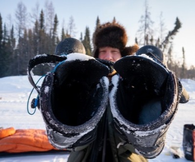
We started day six in a new time zone and our coldest morning yet at -41 on a truckers console. We wanted to make short work of today. We got weather updates from a kind trucker and saw a familiar face on the winter road from Fort Severn who told us of a camp on the bank of a river about 60 miles ahead, closer to our only other community on this route, Shamattawa First Nation. The very community we were raising 10k for. So we struck out for the unknown camp and only hit a little bit of overcast cloud and snow before it was sunny again. The weather on this trip was choice. We had really nice conditions, always cold, only some strong winds and about 95% sun every day. We all noticed our right foot in the 45NRTH Wolfgar boots were chilly and our left foot was always fine. The sun spent all day south of us, keeping our left sides warmer than our right. -35f is pretty darn cold and we were still comfortable on day 6 with no opportunities to dry our liners. Warm biscuits, indeed. Unfortunately, we hit Shamattawa at 5:30 PM on a cold Sunday so the community was silent. A Royal Canadian Mounted Police officer gave us an update on the Covid-19 lockdown situation and said we should call home from the station. Eric and I who both have kids in school and daycare quickly realized how busy our wives had been in our absence. With kids home full time and many businesses shut down, we had a lot to talk about over the last 100 miles. But up here, you can’t just call for a ride or take a bus. We were about 2000 miles from home by road and there’s no scheduled flights in or out. We ended up with 67 miles in today and realized the cabin was a day further. We did get to sleep in a cool old forest fire and made camp about 60 yards away from a gigantic set of polar bear tracks, but with night falling on us, we had to sleep somewhere.
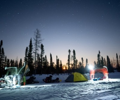
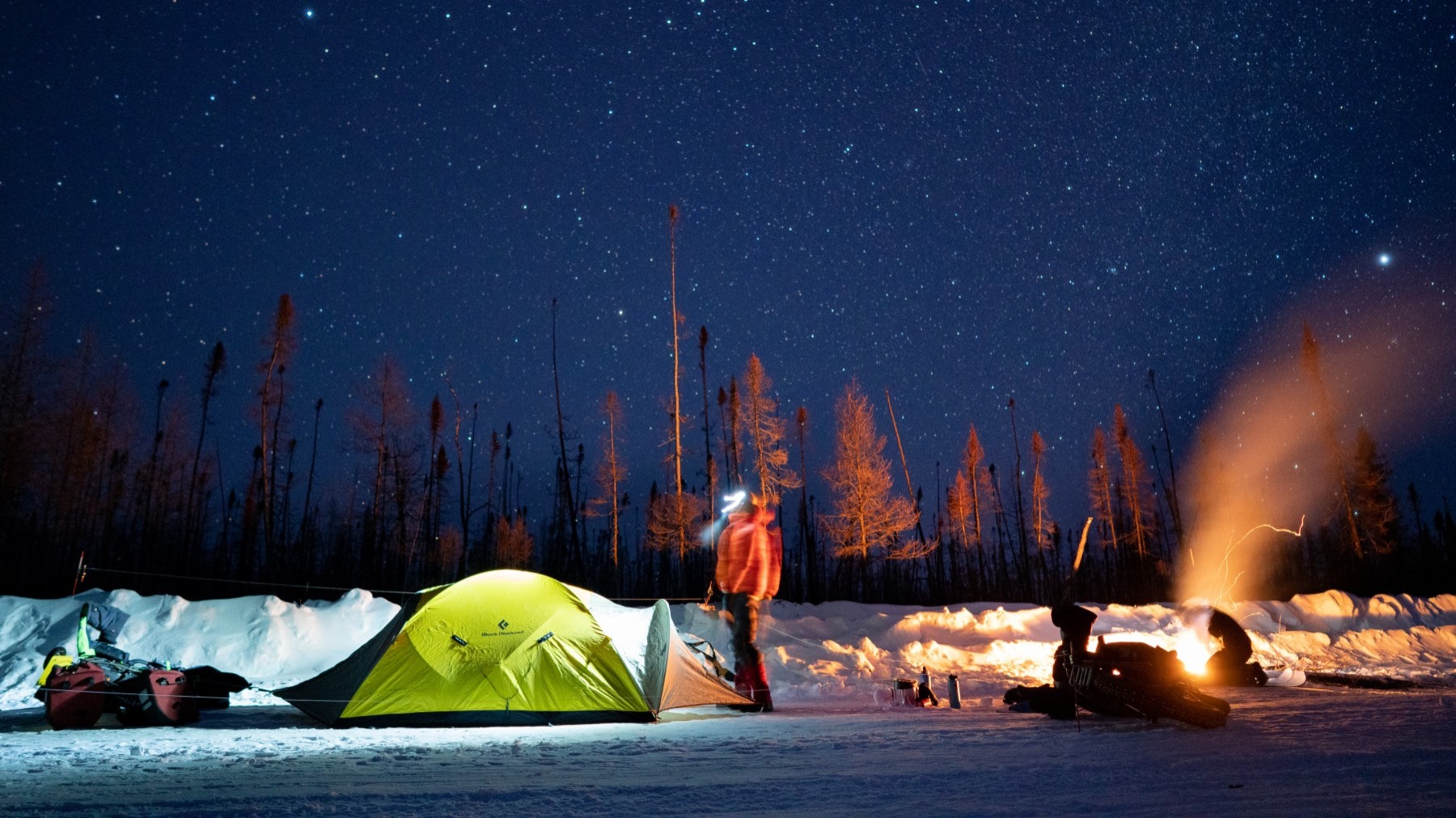
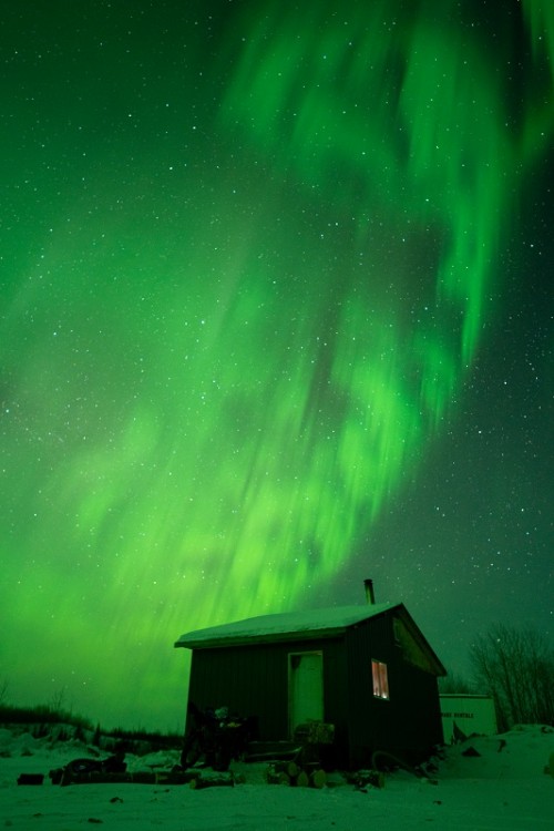
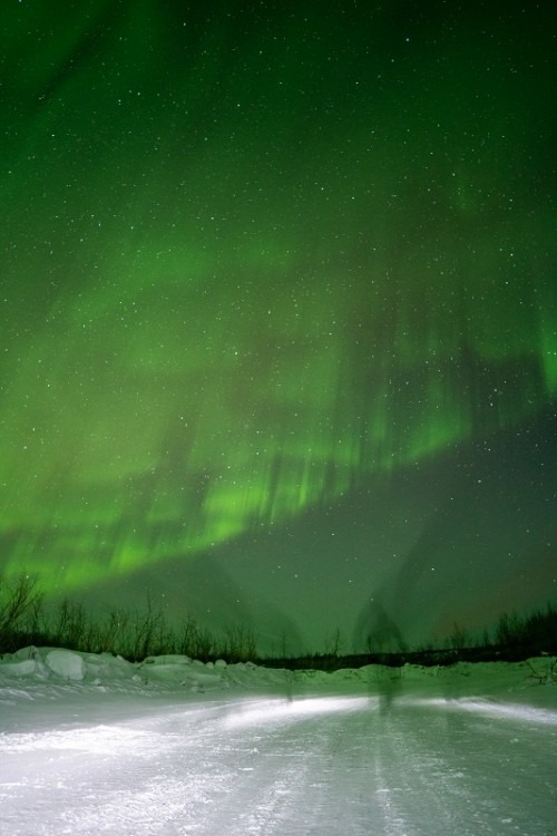
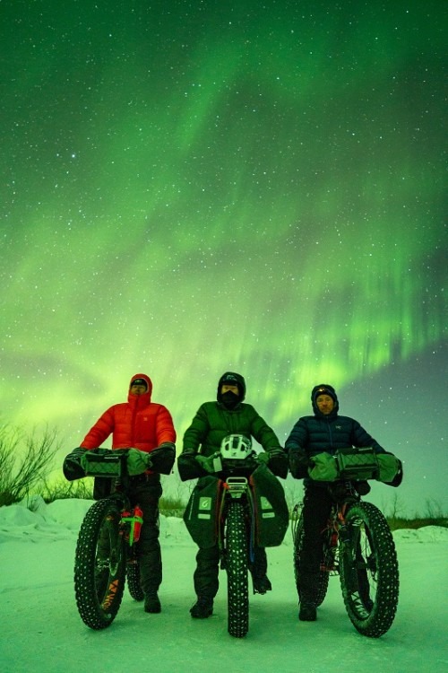
With only two days and about 130 miles to the end, we were ok with pushing a little harder on the bike. We knew that our clothes and sleeping gear wasn’t saturated with moisture enough to make us freeze at night. We were motivated to hammer down a little, the sun was shining, we were into some nice rolling hills and actually had a few nice views. We noticed some trap boxes every few miles on the road. These belong to a trapper of which the marten collected in these boxes are likely their sole income. One of the boxes with a spring steel trap inside had a perfectly preserved and frozen stiff pine marten sticking out. It’s orange, white and black markings were hard to miss. We took a few photos and kept rolling. Today we were met with a few trucks traveling the road, one we had a close call with on a curve and the others just wanted to chat and wish us good luck or thank us for fundraising. Shamattawa has an alarming suicide and unemployment rate. We’re fortunate enough to take time off in our lives and take on such a trip for fun and we couldn’t fathom anything but helping as we use their traditional lands for our benefit and enjoyment. The Gofundme link was hovering around the $8000 mark and we were hoping to get it to 10k by the last day. The miles ticked by today and the morale was high. We passed a few great looking campsites but with only 45 or so miles in we wanted to keep the wheels rolling. It wasn’t 5 miles more and we rolled up to the camp we were told about yesterday. We opened the door of the large mobile-like camp and found an assortment of discarded work clothes, tea, sugar, eggs and water bottles among all kinds of other things. What we really cared about was the woodstove. Was there one? Did it work? Was there a stove pipe? A few days earlier we found a camp that a polar bear trashed and local Cree’s say is haunted. This place looked promising. Stove, pipe, matches and even candles were here. We spent a night in wilderness luxury and even had the original builder of the camp stop by to say hello. He noticed our bikes outside and wanted to talk about our fat tires. He and I ended up having a mutual friend in Moosonee too, very far from here but only 5 communities away. We enjoyed the fire but headed to bed real quick. I hammered about a gallon of water before bed and found myself getting up around 3am for a pee break. I stuck my beaver hat on and walked outside in the -40f air to a pretty lit display of the Auroras. Northern Lights aren’t something seen everyday so I woke the lads. They stumbled out of bed on the promise that it was worth it. We kitted up, pushed off on the bikes for the most uncomfortable photoshoot of our lives on the Hayes River but it’s one we’ll all remember.
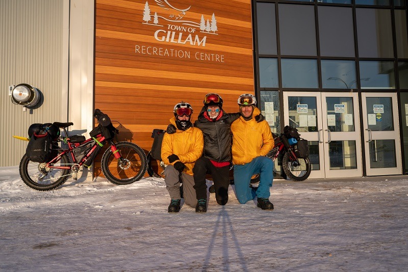
The last day. 8 - 78 miles in 8hrs 24 minutes. We started off from the camp on the Hayes River with a steep leg breaker of a climb on our 80lb bikes. I heard through our GPS that our shuttle driver was in Gillam and waiting for us. Who is this intrepid traveller? My mom. I’m almost 40 and the only person wild enough to drive 2000 miles to save us from flying home during a pandemic is Trudy Miller. A 2x provincial trap shooting champion, mother of 4, retired pastry chef and international traveler who just happens to be from this area of Manitoba. My mom took the opportunity to catch up with family along the way, all of whom I had never met before. We were rolling on RaceFace Turbine cranks for the ride and Ryan’s BB started creaking hard about 30 miles from the end of our trip. Slowly it tightened up. Ryan could be naked on a snowy mountain top and he’ll never complain but he said “guys, my bikes’ really hard to pedal” I wanted to see what the fuss was all about so we swapped bikes for a few miles. It was literally all I could do to turn the pedals over. We rigged up a bungee system and towed Ryan and his limp bike. Eric was on the line and I was riding in the wind. It was an uncomfortable situation for all of us but we’re lucky this didn’t happen earlier on the expedition. We passed an abandoned tractor trailer that was cockeyed over it’s 60’, badly twisted from the driver picking a real bad line over the short, steep 3 and 4 foot frozen rollers. They were fun to ride for us but claimed an expensive rig or two this season. We weren’t long when a silver minivan was noticed in the distance. Bouncing around, headlights appearing and disappearing. My dear Mom had visited all her family in Gillam and decided to see some of the winter road. We said hello, and thank you, but kept on the bikes for another 3 miles to the trails official end. All that was left to ride was 12 miles into a block headwind on a gravel road. The day was getting on, the sun was setting and we rolled into the Town of Gillam at dusk. We had plans to talk at a school and have a meet and greet with the community but Covid shut everything down. A hot meal, shower a few pints in the hotel room had to be good enough. Our Strava file tells us we rode 450 miles in total. We were happy to see we surpassed our 10k fundraising goal for True North Aid and reached $12,000 bringing our Expedition Ontario teams total up to $22,000 raised for Indigenous Youth in the communities we rode through with the James Bay Descent and now the Wapusk Trail.
This expedition was a pretty serious undertaking. There’s so little information available online about the route that we pulled it together almost blind. The road had just opened before we flew into Peawanuck 8 days earlier. These communities aren’t used to sharing info about the route because it’s used so little by outsiders. No one asks about the Wapusk Trail. It’s a local road and we didn’t see more than 15 passenger vehicles over the 8 days riding. Each year the road season gets shorter and shorter. It’s construction is heavily dependent on funding too. If you’re looking for a serious winter fat bike expedition, the Wapusk Trail will provide you with next level challenges. It’s in a seriously remote and beautiful part of Canada. If you’re comfortable in bear country, put this trip on your list of things to dream about when Covid lets us travel again. Thanks for following along.